Link to GitHub: https://github.com/luomus/FinBIF-QGIS-plugin
Column definitions: https://rs.laji.fi/terms
Overview
The FinBIF API Plugin for QGIS allows users to fetch openly available data from the FinBIF API and load it directly into QGIS. This plugin provides a user-friendly interface to query the FinBIF API and visualize the data on a map.
Features
- Fetch data from the data warehouse endpoint of FinBIF API
- Load data into QGIS as vector layers
- Support for various query parameters including taxon, geographical, and quality parameters
- User-friendly interface
Installation
- Go to the “Plugins” menu in QGIS and start typing “FinBIF” into the search bar. Click the plugin “FinBIF_QGIS_Plugin” and install it.
- The plugin should be visible on the QGIS toolbar
Usage
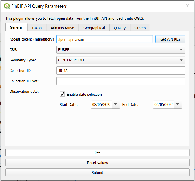
- After installation, add your access token to the first field. If you don’t have it, click “Get Access Token” button and fill in your email. Your access token will be send to your email where you can copy it from.
- Fill in the other fields you want to limit the number of occurrences.
- If you need something that is not predefined in the plugin fields, you can add extra parameters on the Others tab. You can use the same syntax as in the Data Warehouse endpoint. For example, parameterName=parameterValue. Use commas (,) when you want to use multiple values and & when using multiple filters. For example:
- lifeStage=ADULT,JUVENILE&sex=MALE,FEMALE&individualCountMin=1
- Finally, click ”Submit” to start fetching occurrences. They will appear on the map.
- You can find column descriptions on https://rs.laji.fi/terms
Things to Note
- An access token is required to use the FinBIF API.
- Check the accuracy of your search criteria before starting a query to avoid unnecessarily burdening the API with requests for millions of records.
- The plugin only retrieves open data. As a result, the location/time information for sensitive species may be coarsened for some sensitive species. Read more about Sensitive Data.
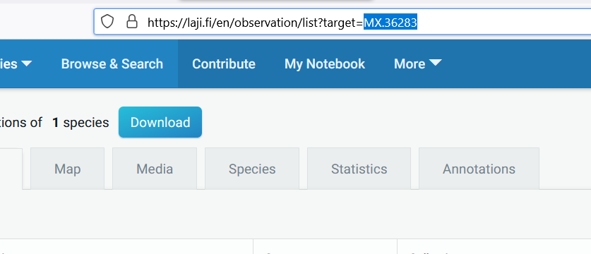
- Taxon IDs and collection ID can be found from laji.fi page when searching for different species, collections, or taxon groups and copying the ID from the URL when the search is performed.
- Taxon IDs are in the form of MX.12345. You can also use species names (scientific / Finnish / English).
- Collection IDs are in the form of HR.12345
- Informal taxon groups are in the form of MVL.12345
The plugin is designed to facilitate the use of species observation data in QGIS. Feedback is welcome.